


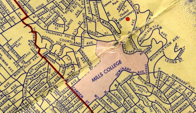
Idea: can we create a series of maps showing the evolution of the road system of Oakland?
So I have been working through the joys of georefrencing. To Dan's future students, I hope that QGIS makes it easier between now and when you're doing it because I've discovered five ways to do it wrong.
Freeways rewrite neighborhoods. They create borders, destroy properties, leave businesses that once were prosperous on the roadside in the dust.
|

|

|

|
||
Working Data
MillsAreaParcels2013.shp
MillsAreaParcelsBefore580.shp (to be edited)
MillsAreaStreets2013.shp
MillsAreaStreetsBefore580.shp (to be edited)
MillsNorthBefore580.qgs
Resources
Article mentioning Mills Station on Oakland streetcar line
A map viewer for old Oakland maps
Spatial History Project at Stanford
Imagery from Cultural Landscape Project